Sunday, 29 August 2010

Grace and Carson again!!

East Dix 056

East Dix 005
I headed out on Friday morning at 7 from the Elk Lake trailhead, knees still sore from the Allen hike. Lucky that there were spots in the parking lot as there was a waiting list when I got back. A few people were signed in ahead of me, the most recent of which were apparently hiking Dix and Haystack (Good luck with that bushwack). It had rained on Thursday night but it was nothing you couldn't walk around and I had some brand spanking new hiking boots with a gore-tex liner so I was safe. I passed one group and then didn't see anyone until much later. The Dix range has a nice remote feel to it and each of the peaks in the range has great although different views.

East Dix 042
I followed the Lillian Brook trail up to the Macomb-Carson col. I think that trail is my favorite of all the herd paths. I understand it used to be one of the worst so a lot of work must have been done to clear all the blowdown. From the col it is a short climb to the Carson summit. I picked a great weather day as it was blue skies and no haze to obscure the great view. A few photos and off to Grace. I'm not sure about the rules for including peaks in the 46 but there doesn't seem to be much descent and only a short climb up to the Grace summit.

East Dix 055
The summit marker is nailed to a large boulder. There is somewhat of a view if you stand on the rock but the real treat is when you follow the herd path past the summit and come to the ledges that look across the Bouquet valley at Hough and Dix as well as down the Keene Valley and over at Giant and Rocky Peak ridge. I have a feeling that this might be the best spot in the High peaks to see the fall colors. I had a peak over the edge at the slides which must be pretty steep as I could only see the lower sections. I dropped a lens cap from my new camera down a deep crack so if you find it somewhere below...

The trip back was pretty slow as I had the same knee issues as from the Allen hike. It took more than two hours to get down the LB trail. I think I will have to stick to short hikes for a while.

See more photos on flickr.

Labels: , , ,

Tuesday, 10 August 2010

A slippery day on Allen

2010-08-07 Allen from Upper Works 062

2010-08-07 Allen from Upper Works 097
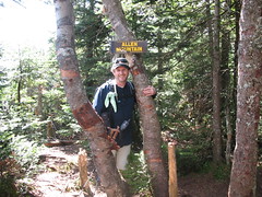
For obvious reasons I left most of the difficult 46er hikes to the end. All of the ones I have hiked this year have been either long hikes or remote hikes or long and remote. Well they don't get any more remote than Allen and most are not as long either. Last Saturday was a perfect weather day with little humidity and not much recent rain. I managed to book a spot in the annex to Aunt Polly's which is a b@b in Newcomb nearby to the Upper Works trailhead. This is the perfect spot to stay in order to get an early start for Allen or the Santanonnis and the hosts are great folks. I hit the trailhead at 6ish and was first in the lot. Ken had said he might show up but after a 10 minute wait I decided to take off solo. Turns out he had an appointment he had to keep but by the end of the day I could think of several other reasons to avoid this hike.

2010-08-07 Allen from Upper Works 051
Allen is a hike broken down into two sections. The first is long and flat and quite scenic. It is about 8 miles of gravel roads and dirt tracks that crosses land owned by various hunting clubs. All intersections are well marked and it is easy to follow. Near the end of the yellow disk marked trail is a crossing of the Opalescent river. It was low when i got to it but I still made use of the sandals I brought along. As I was changing shoes another hiker came along and although I offered the use of my sandals he proceeded to walk across the calf deep water in his hiking boots. To each his own I guess. I caught up to this fellow a half hour later as we both started the ascent.

2010-08-07 Allen from Upper Works 058
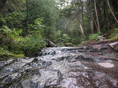
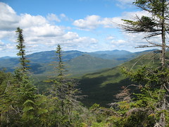
The second part of the hike is the ascent up the mountain beside or in Allen brook. This has to be the steepest trail section I have encountered in the Adirondacks as it gains 2000 feet in about a mile and a third. Add to that the slippery surface of the rocks with some nasty brown slime that is slippery even when dry. Deliberate steps are called for. About two third of the way up when you are stopping often to catch your breath there are nice views of Mt Adams, the Santanonnis and the Sewards. We hiked up the trail together and reached the top after about two hours. There is a sweet view to the east with the highlight being the angle of Haystack and Panther Gorge.

2010-08-07 Allen from Upper Works 069
The hike out was a real grind for me. I met four groups of hikers coming up as I descended slowly. I wiped out once on the slime and thought I had seriously damaged my left knee which hurt with every step. This is not a good thing when you have 9 miles to get back to your car. Luckily I experienced some sort of Allen miracle because as soon as I made it back to flat ground it felt fine. To re-cross the river I again used the sandals. I had planned on leaving them there for others to use but one worked it's way loose as I walked across and floated away downstream. Since one shoe is kinda useless I tossed the other in as well. With any luck they are well on their way down the Hudson by now. If you find them, well you're welcome!! There were several groups coming in to camp including one misguided youth in a Toronto Maple Leafs t-shirt that I heckled appropriately. I staggered into the parking lot about 12 hours after I left. It was a well earned 45th but at the time all I was thinking about was the ice cream cone I was going to get at the Stewarts in Long Lake.

For more photos you can check out the flickr set.

Next stop...the Great Slide on Grace (East Dix)!!

Labels: , , ,